UK Bridleways, Byways, and Footpaths Map
Find bridleways, byways, and footpaths close to you using our map and search tools, covering England and Wales.
Our bridleway map lists every recognised bridlepath, byway, and footpath near to you. Despite the fact that bridleways are an important resource for cyclists and equestrians alike (providing respite from traffic-laden roads) they’re notoriously hard to find. We’ve built two great tools to assist you in finding bridleways in your area.
Although most public rights of way are outlined on Ordnance Survey maps, less popular routes are often omitted. The best place to find all of the available rights of way (including bridle paths) in your area is the Definitive Map. The Definitive Map lists every official right of way under the jurisdiction of the authority that publishes it. Even if you think you know about all of the bridleways in your area, it’s worth checking – you might even find you’re riding somewhere you shouldn’t be!
Bridleway, Byway, and Footpath Map
To find bridleways, byways, and footpaths in your area check out our map below. Select the type of path you’re searching for in the right hand side menu, and navigate to the correct area using the search box or your location.
Alternatively, use our Bridleway, Footpath, and Byway search tool. Simply select your area from the drop down to retrieve the definitive map, and therefore every legally recognised bridleway, footpath, and byway.
Bridleway, Footpath, and Byway Search Tool
We’ve compiled every available digitised definitive map in England. If your area’s missing then you can request to view a physical copy by contacting your council, alternatively check out our “Alternative Resources” at the bottom of the page.
Note: digital definitive maps are not legal records. When pursuing a legal claim you should always reference an original, physical copy.
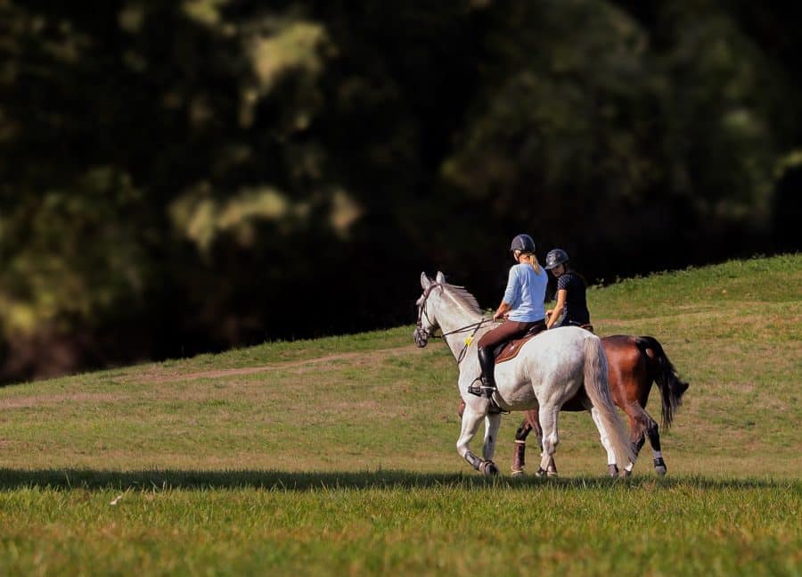
Where can you ride a horse?
As we’re all aware, you can’t ride along a public footpath, however, bridleways aren’t the only place you can ride off-road. Other rights of way, such as restricted byways, are also open to riders.
| Type | Description | |
|---|---|---|
| Footpath | 🚫 | A path used only for walking (different from a pavement). No horses allowed! |
| Bridleway | 🐎 | A route open to those leading or riding a horse, pedestrians, and bicycles. Horse drawn vehicles are not allowed, and cyclists must give way to pedestrians and horse riders. |
| Byway open to all traffic (BOAT) | 🐎 | Open to horses, all wheeled vehicles (including horse drawn vehicles), cyclists, and pedestrians. |
| Restricted Byway | 🐎 | Open to horses (led and ridden), pedestrians, cyclists, and non-mechanically propelled vehicles. |
| Green Lane | 🐎 | Equivalent to a BOAT. |
Where can you ride? (Modified from Naturenet)
Bridleways in London
Rotten Row, a bridleway located in Hyde Park, is not widely known outside of London. It is primarily used by the Household Calvary, a unit of the British Army stationed nearby in Whitehall. Despite this, the bridleway is open to the public and can be easily accessed from nearby stables that offer horse rentals. The bridleway is a popular destination for horseback riders and offers a unique way to explore the park’s scenic routes and beautiful surroundings. Rotten Row is also known for its rich history, having been established in the late 17th century as a fashionable place for wealthy Londoners to ride their horses.
Overall, the extensive network of bridleways in London make it a great place for horse riding enthusiasts, providing you can avoid the road traffic! Whether you’re an experienced rider looking for new trails to explore, or a beginner looking to take your first ride, there are plenty of options to choose from.
If you don’t own your own horse, there are several stables in London that offer horse hire. If you’re interested in hiring a horse to ride in Hyde Park consider Ross Nye Stables or Hyde Park Stables.
We hope we’ve helped you discover a new riding route. If you’re looking for new places to ride then make sure to follow us on Instagram as we’ve got an exciting new bridleway project coming up soon that we need your help with!
Could you tell me where the bridleways are in the Dunham Massey, Altrincham and Lymm Cheshire areas, please?
Hello Barry, thank you for your question. Bridleways in this area are disclosed at the following locations:
– https://maps.cheshirewestandchester.gov.uk/
– https://maps.cheshireeast.gov.uk/
If you’re interested in finding bridleways in other areas please see our tool under the heading ‘Finding Bridleways: English County Councils & Unitary Authorities’.
I am looking for bridleways near Bicester so I may enjoy a bicycle ride. Is there a map for these? I am new to UK. Thank you
Hi Joe, Bicester is under Oxfordshire County Council. The following map should be of help.
https://publicrightsofway.oxfordshire.gov.uk/StandardMap.aspx
If you’re interested in finding bridleways in other areas please see our tool under the heading ‘Finding Bridleways: English County Councils & Unitary Authorities’.
Hi I’m trying to find bridleways in the North of Sheffield thanks.
Hello Julie, please select “North Yorkshire County Council” from the drop-down (purple box) above, and follow the link.
Hi do you any available bridleways in Wales
Hi I followed the link suggested for North Yorkshire county council but that doesn’t cover Sheffield as we are South Yorkshire and there is nothing in the drop down menu for Sheffield or South Yorkshire can you help we are the North side of Sheffield near Barnsley and we desperately need to find new routes for riding as at the moment it consists of a lot of road work around the council estates which can be perilous at times thanks.
Apologies. We will work to include your area in our tool. In the mean time, please see the links below for Sheffield and Barnsley right of way information.
– Bridleways in Sheffield: https://sheffieldcc.maps.arcgis.com/apps/webappviewer/index.html?id=f05ea9f0d02f45238dcc410dfee4c2b2
– Bridleways in Barnsley: https://www.barnsley.gov.uk/barnsley-maps/public-rights-of-way/
hiya. Looking for a bridleway on Exmoor.
Please see the following map showing bridleways on Exmoor
https://www.whatawalk.com/map/?zoom=10.763306464965419&lat=51.05493707762821&lng=-3.5505958094124708&style=outdoors-v11
The Surrey Council link doesn’t work. It says error page.
Hi Andy, thanks for letting us know. This has now been fixed.
i am looking for bridlepath information in Rotherham with a Sheffield postcode s252ry
Hi John, information for Rotherham can be found at the link below. A word of warning: the council are currently in the process of updating the map, so some routes may be missing.
https://www.google.com/maps/d/u/0/viewer?mid=1mZfzobl4lk0cnrVcNwVCYcPIGlXGAjU5&ll=53.42062241022728%2C-1.2959548500474605&z=11
I’m an off-road cyclist who likes to explore nature away from cars and I just wanted to say that this online map that you have created is a very useful resource, where many are not so accurate or comprehensible. Thanks! M
I think you drive anywhere you want on your own land.
If one buys land only to discover that a bridleway is the only route of access to that land, can a small car use the bridleway to and from the land?
Hi looking for bridal way cheam morden
I am looking for bridlepaths and by-ways in HEREFORDSHIRE but the map provided is for HERTFORDSHIRE! Please could you correct this. Thank you.
Thank you. This has now been resolved.
Hi this is a great resource thanks. I see theres no map for West Yorkshire. Any ideas where to find one?
Hi Helen,
Footpaths, bridleways, and byways in West Yorkshire can be found at the following URL:
https://www.whatawalk.com/map/?zoom=9.545805328355685&lat=53.74202581158872&lng=-1.686054016000071&style=outdoors-v11&footpaths=true
Hi please can you tell me if the path between Fly Hill & Undercliff in Bakewell Derbyshire which is marked with both red for a footpath & the brown segmented line is a BOAT & therefore can be ridden.
The Forest Way is the old railway line that runs between East Grinstead and Hartfield. It is equivalent to a bridlewaybut not marked as such on your map. I wonder if other similar paths are omitted?
I am soon to move to Dumfries DG5 I have tried to find bridleways on yr maps but nothing shows can that be right
Hi, Staffordshire CC link fails